

| MENU |
In 1086 Caldy was part of the Manor of Calders which is an old Anglo Saxon word meaning "Cold
Arse", named after a hill. It alluded to the prominent hill on which lie Grange and Caldy. It also gave
its name to the hundred of Caldy, within the hundred of the Wirral. A hundred within a hundred it not
known anywhere else on the Wirral thus making Caldy unique amongst its peers. This is because all
of the manors named as part of Caldy belonged to Robert Rhuddlan, Earl of Chester or the semi
independent Norse colony permitted to settle there. Caldy is on the west side of the Wirral peninsula
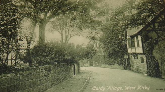
and is developed around the old village and Caldy manor which dates from the late 17th century. It
was first mentioned in the Domesday Book in 1086 as being owned by Hugh of Mere. Nearby is a
large area of National Trust land called Caldy Hill. Many of the houses and walls are built from the local
red sandstone
To the north west, the village is bounded by the National Trust property known as Caldy Hill whilst the
Dee estuary marks the western boundary of Caldy with more modern executive homes fringing the golf
course. In 1832 the village was bought by a Mr R.W.Barton. A small public-house called the Hop Inn
used to stand in the village. During the construction of the West Kirby to Hooton Railway in the 1880's
the landlord of the Hop Inn, made a comfortable living by taking barrels of ale down to construction
workers employed on the railway. The small inn later became a shop, this has now been converted
into private house. At the turn of the 1900's, the village had a number of working farms, and the
community was surrounded by open fields. The Manor House was occupied by James Ismay, whose
father founded the White Star Line.
Development from 1906 to the late 1960s was by way of disposal of individual plots, in most instances
for the purposes of the construction of single dwellings. The methods of sale continued to constitute a
quite effective way of preserving the special character and nature of the Caldy village, which was one
essentially of a low density area of good quality housing offering a high environmental quality. The
Manor house was used for a time as a heart hospital in the 1950's. Today the building has been
converted into flats. The majority of the village was designated a conservation area in October 1974
and only primarily residential use is permitted.
At the time of the 2001 census, Caldy had 1,290 inhabitants, of a total ward population of 12,869.
Caldy Hill is an area of lowland heath and mixed deciduous woodland, located on a sandstone outcrop
overlooking the Dee estuary. The area includes Stapledon Woods and lies to the south west side of
Column Road (A540). Newton Common lies on the north side of Column Road and is a small, mainly
oak, woodland. Grange Hill is located off Lang Lane, West Kirby and is an area of gorse and bracken
scrub.
Arse", named after a hill. It alluded to the prominent hill on which lie Grange and Caldy. It also gave
its name to the hundred of Caldy, within the hundred of the Wirral. A hundred within a hundred it not
known anywhere else on the Wirral thus making Caldy unique amongst its peers. This is because all
of the manors named as part of Caldy belonged to Robert Rhuddlan, Earl of Chester or the semi
independent Norse colony permitted to settle there. Caldy is on the west side of the Wirral peninsula
and is developed around the old village and Caldy manor which dates from the late 17th century. It
was first mentioned in the Domesday Book in 1086 as being owned by Hugh of Mere. Nearby is a
large area of National Trust land called Caldy Hill. Many of the houses and walls are built from the local
red sandstone
To the north west, the village is bounded by the National Trust property known as Caldy Hill whilst the
Dee estuary marks the western boundary of Caldy with more modern executive homes fringing the golf
course. In 1832 the village was bought by a Mr R.W.Barton. A small public-house called the Hop Inn
used to stand in the village. During the construction of the West Kirby to Hooton Railway in the 1880's
the landlord of the Hop Inn, made a comfortable living by taking barrels of ale down to construction
workers employed on the railway. The small inn later became a shop, this has now been converted
into private house. At the turn of the 1900's, the village had a number of working farms, and the
community was surrounded by open fields. The Manor House was occupied by James Ismay, whose
father founded the White Star Line.
Development from 1906 to the late 1960s was by way of disposal of individual plots, in most instances
for the purposes of the construction of single dwellings. The methods of sale continued to constitute a
quite effective way of preserving the special character and nature of the Caldy village, which was one
essentially of a low density area of good quality housing offering a high environmental quality. The
Manor house was used for a time as a heart hospital in the 1950's. Today the building has been
converted into flats. The majority of the village was designated a conservation area in October 1974
and only primarily residential use is permitted.
At the time of the 2001 census, Caldy had 1,290 inhabitants, of a total ward population of 12,869.
Caldy Hill is an area of lowland heath and mixed deciduous woodland, located on a sandstone outcrop
overlooking the Dee estuary. The area includes Stapledon Woods and lies to the south west side of
Column Road (A540). Newton Common lies on the north side of Column Road and is a small, mainly
oak, woodland. Grange Hill is located off Lang Lane, West Kirby and is an area of gorse and bracken
scrub.
| |
| |


| The Old School |
| Caldy Road B5140 Today |
| The Memorial Stone 1897 |
| Caldy Manor 1901 |
| Church of the Resurection and All Saints |
| Manor Farm 1902 |
| Do you these photographs bring back any memories of Caldy ? Do you have any photographs or additional information ? If so please contact me oldwirral@yahoo.co.uk |
| | | | | | |