

| MENU |
| |
| |
| |
| |
| |
| Where is the wreck ? Latitude: 34° 37’ 48,8” S Longitude: 19° 18’ 10,9” E |

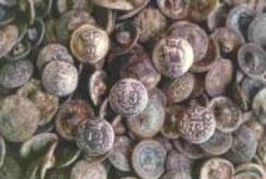


A small number of artifacts have been recovered from the wreck of HMS Birkenhead including badges, coins and
personal belongings:
personal belongings:
| This painting shows how the HMS Birkenhead looked shortly after hitting the rock. |

| The photograph shows the plaque found at the light house at Danger Point. By standing in front of the plaque as shown in the picture, you can line up the groove in the plaque and look out to sea. This shows exactly where the HMS Birkenhead sank. |

| LEFT: The picture to the left shows the plaque erected in memory of those who lost their life on board the HMS Birkenhead and to those who showed remarkable courage in the face of adversity. |
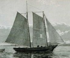
| The picture below shows a Schooner which was the type of ship that assisted in the rescue of some of the survivors from the Birkenhead. |

| Elizabeth on the right. Sadly it struck a rock now known as the Birkenhead Rock at Danger Point. |
| | | | | | |